© RivEX 2024
Create reach polylines for sites along your river network
■
Create downstream nearby network
■
Create upstream nearby network
■
Create site centred reach
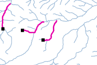
Using snapped sites as a starting point, RivEX can generate reach polylines in an upstream, downstream or both directions. Such polylines can be used to map zones of sedimentation upstream of a weir, impact zones downstream of a barrier, limits of movement for a species. Reaches track along a single channel.
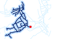
If you need to understand an impact for all possible routes then you can use the nearby network tools.
Available tools are:
5Km upstream nearby
network extracted
Downstream 1Km
reach extracted
More advice about reach tools is given in the manual.

